

Many years ago I stumbled across this fantastic picture of houses on the edge of a quarry in Spring Hill.
I loved the apparent precariousness of their situation, and the casual attitude of the people in the photo, especially the person up in the top right, leaning on the verandah rail.
At the time my research took me in another direction, but I always wondered about the quarry.
Where had it been? Was it still there? How long did it operate?
Luckily, my friends at the Asia Pacific Design Library gifted me the opportunity to find out.
I was invited to be part of Design Finds, an event associated with the Asia Pacific Design Forum, running 1-10 March at the State Library of Queensland.
All I had to do was select five items from the library’s Queensland Memory collection, and then respond to those items in some way. There were no other constraints about which items I could choose, or how I could respond.
That’s where the photo of the quarry came in, retrieved from the spot in my memory it had so charmingly occupied for all those years.
If I’m being honest with you, I first flirted pretty hard and fast with another quarry.
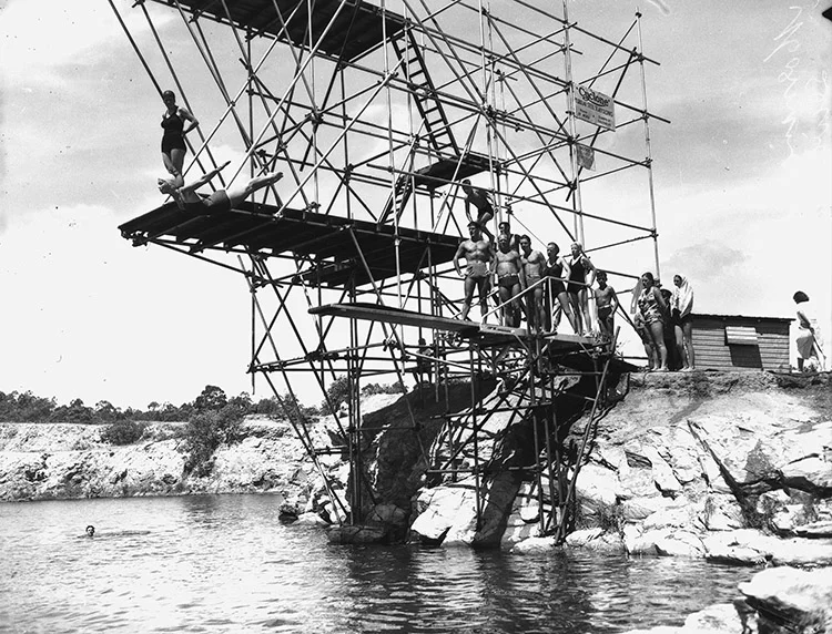
Image: State Library of Queensland
This photo is of the former Morningside quarry - just look at that towering jumble of scaffolding, those gleaming muscles, that glorious, diving woman. Oh my!
When quarrying operations ceased at this site, the pit filled up with water.
Locals used it as a pool.
During the second World War it was reportedly the final resting place for scores of old army jeeps and other machines.
In 1949 there was a major kerfuffle when it was announced as the location for the national diving championships – the Queensland diving powers-that-be had the quarry dredged so no one pike-positioned themselves onto a pile of old jerry cans.
But whilst there were lots of stories about the Morningside quarry, it had left few documentary traces – I couldn’t find it on a single map.
I dumped Morningside, and its flashy, come-hither photo, and returned to Spring Hill and a cornucopia of material.
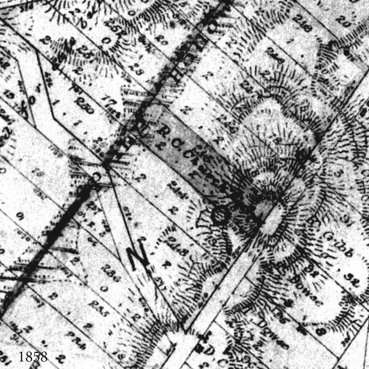
My first step was to locate the quarry.
The most perfunctory Google Maps search revealed 4 Quarry Streets in Brisbane, including, helpfully, one in Spring Hill. (A later search of Brisbane’s first street directory, published in 1955) revealed no less than 7 Quarry Streets and Roads).
Now I knew where it had been, I then wanted to know when the quarry had first appeared.
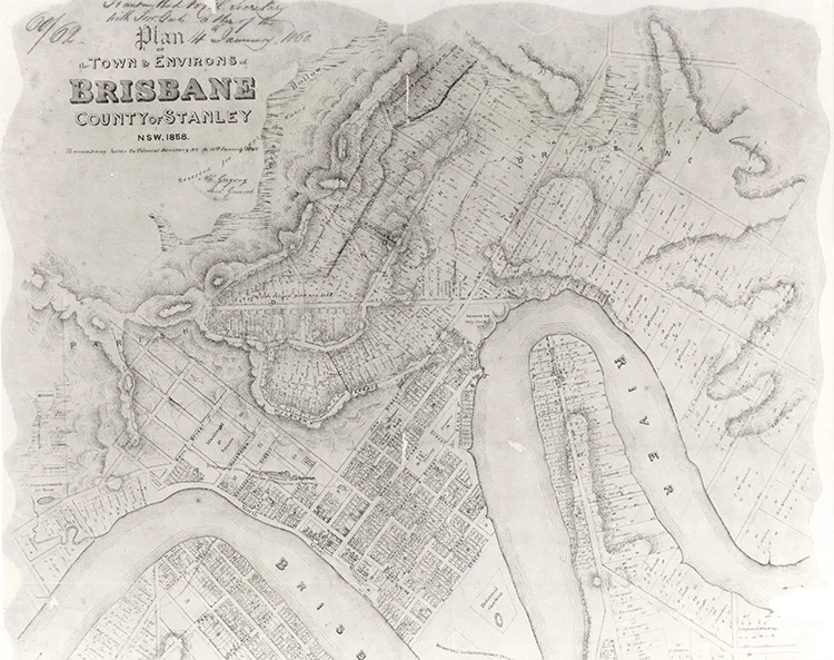
Image: The Town and Environs of Brisbane, County of Stanley, NSW, 1858. State Library of Queensland.
This exquisite map shows the landscape in all its topographical detail, but a grid network of streets and blocks is overlaid. The Spring Hill quarry hasn’t begun to exist yet, but we can see its future location on Lots 246 and 247.
The map, from 1858, captures not just the location of our future quarry, but the transition time between a pre- and post-European landscape in Brisbane.
With the lot number and address established I was able to track the quarry site over the next 150-plus years, capturing moments in time that had been recorded in maps, books and photographs.
Here are some of those moments:


For the Design Finds event I was asked to select 5 items.
The first four objects - the photo and three maps - are described above.
The final object is a stack of the twelve documents that formed the Environmental Impact Statement required for a recent quarry application at the Gold Coast.
They show the changing social and environmental attitudes, and community expectations towards local extractive industry, a long way from the matter-of-fact nature of the Spring Hill quarry a century earlier.
Then I was asked to respond to the 5 items in some way.
The quarry was a site of extraction, situated on a dramatically layered and tilted geological formation. The use of the site has also changed over time - layers of history – and will presumably continue to change with the city.
My response uses transparent layers, each showing the quarry location at a different point in time.
Each image is printed on a sheet of clear acrylic, and then stacked in a timber stand.
This page will be updated after the exhibition, with photos of the finished object.